Traveling is great for many reasons. But my favorite reason is, I get to explore local trails and mountains otherwise I wouldn’t have the opportunity to. There are so many interesting trails to explore but we wouldn’t necessarily make plans to visit every mountain especially small mountains that are only known to the locals.
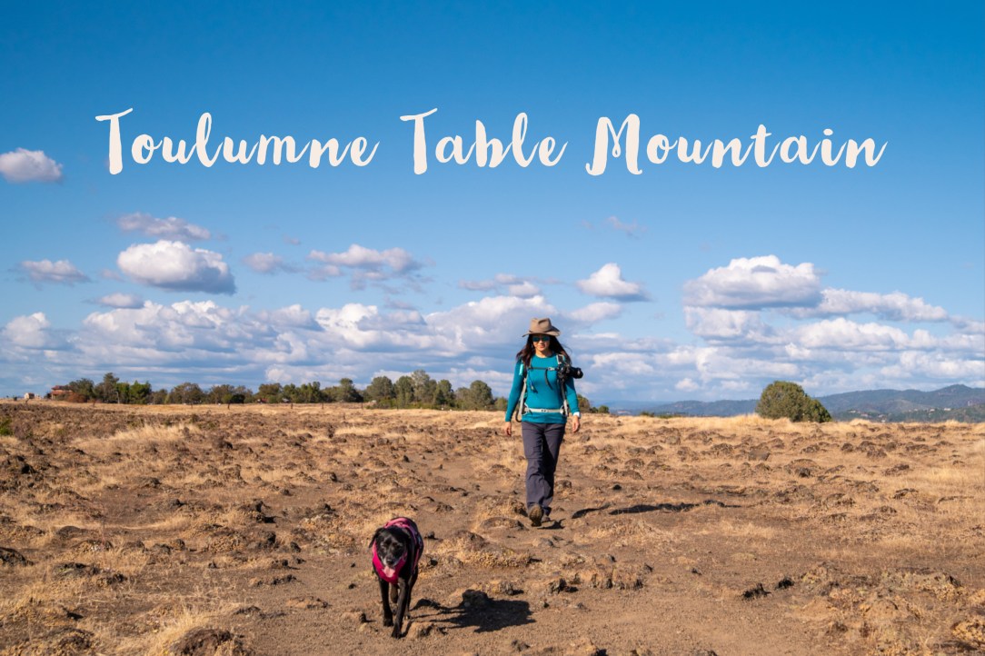
Tuolumne Table Mountain is a good example of this. Now here is an interesting hike near Jamestown, CA. We had a chance to visit Tuolumne County up north late September. Once we were there, I looked online and found this hike. Although we would not have made a special trip from Southern California to Jamestown to hike this, since we were there, we decided to check it out. And I am so glad we did!
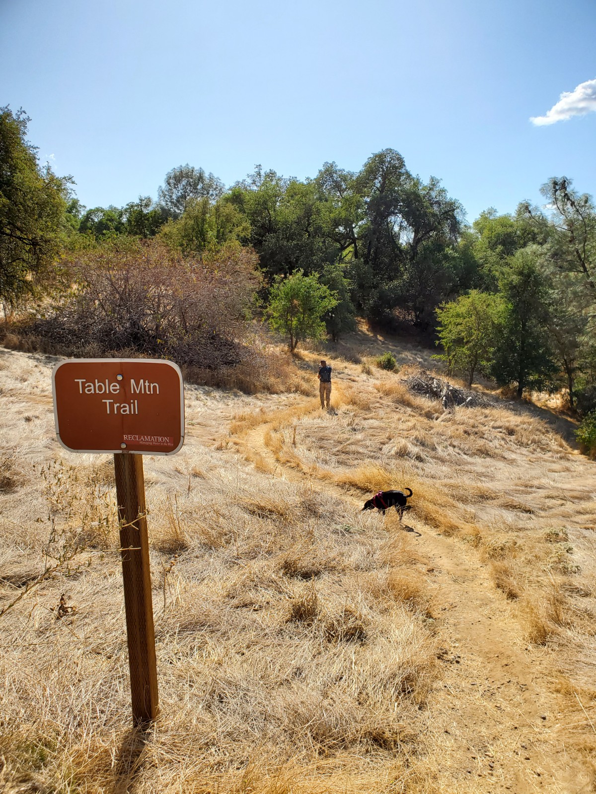
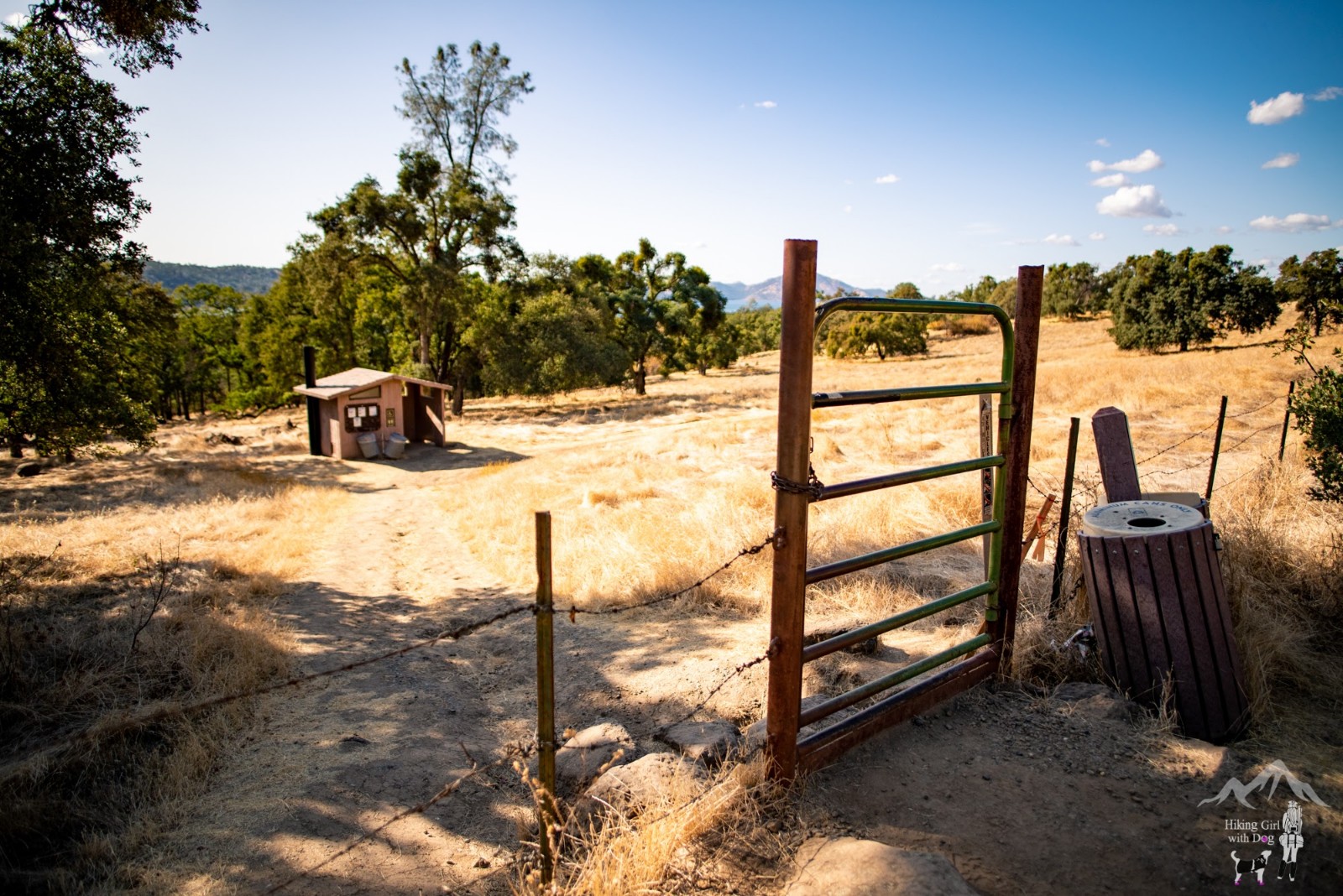
After parking in the small dirt lot near the trailhead, we began the hike behind the cattle gate in the late afternoon.
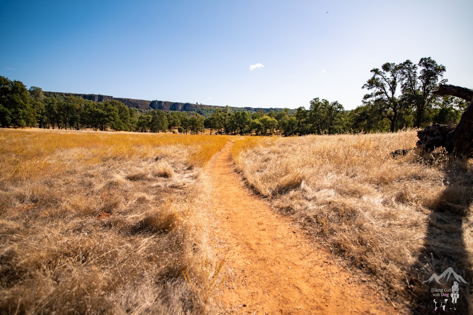
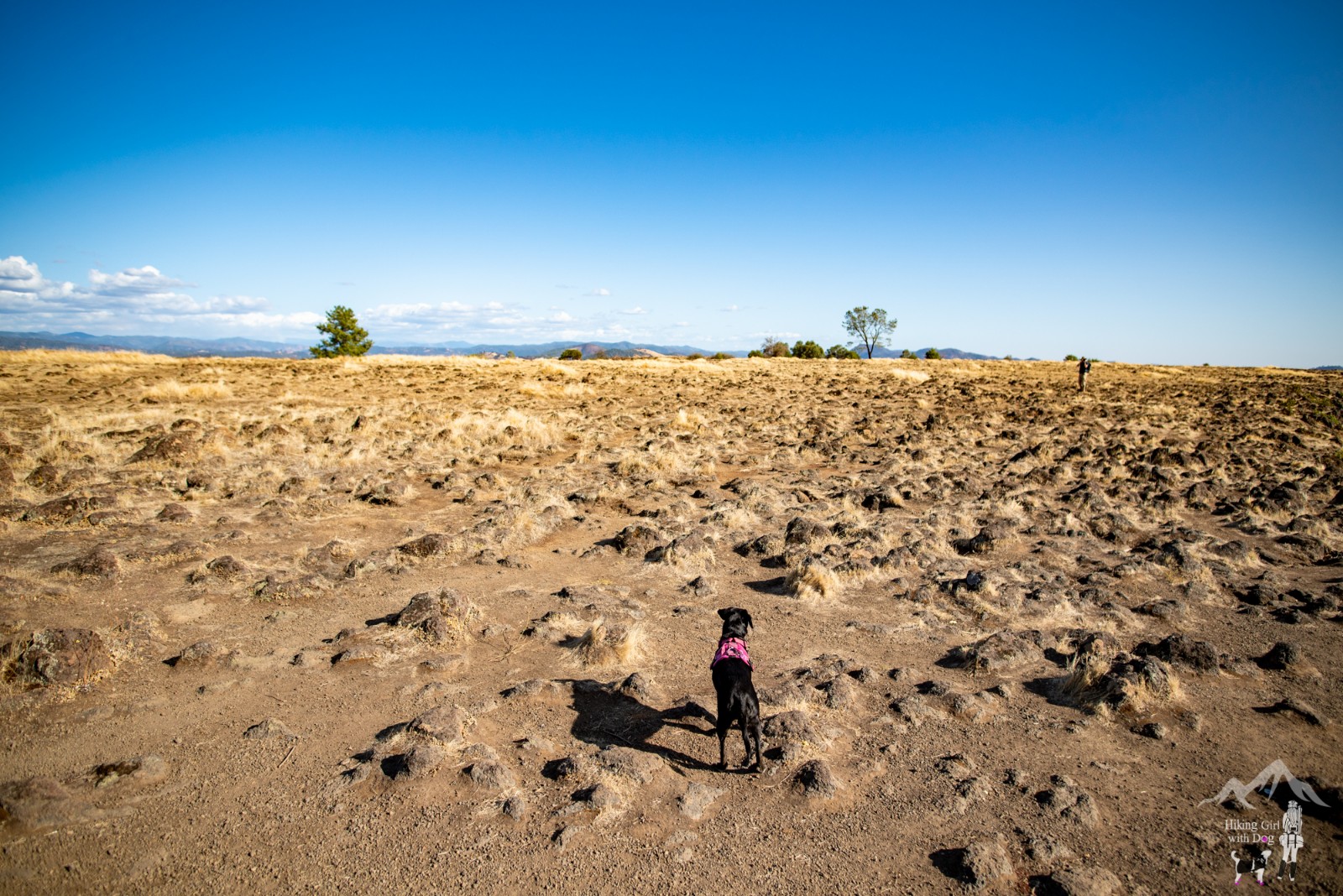
[Tuolumne] Table Mountain is an inverted valley, an elevated landform which follows the former contours of a river valley above level of the surrounding topography, rather than below it.
The flat-top landscape behind the tree line in the picture below is Tuolumne Table Mountain.
The first half of this short hike – the total distance is only 2.4 miles – was very easy. It’s just a walk through a field. The late afternoon sun rays luminesced this empty field golden and beautiful!
When you arrive at the restroom, you are halfway to the mountain top. The restroom was so well kept to my surprise. Probably the cleanest vault toilet I’ve used on a hike!
Next, walk toward the cattle gate. I took this picture after we came through the gate.
The trail continued behind the white gate. The fun part of the hike is about to begin!
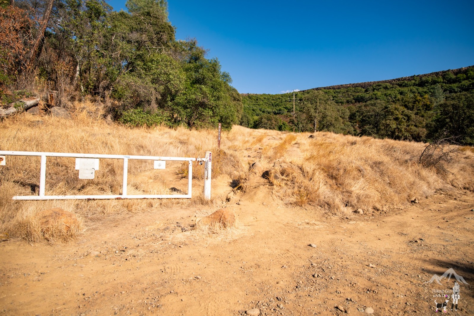
What a change of scenery all of a sudden! Soon after the white gate, the trail led us to a mini forest.

Then the switchbacks began followed by rock climbing.

Although the slope is steep, hang in there. It’s short and soon you will be at the flat top of the mountain.
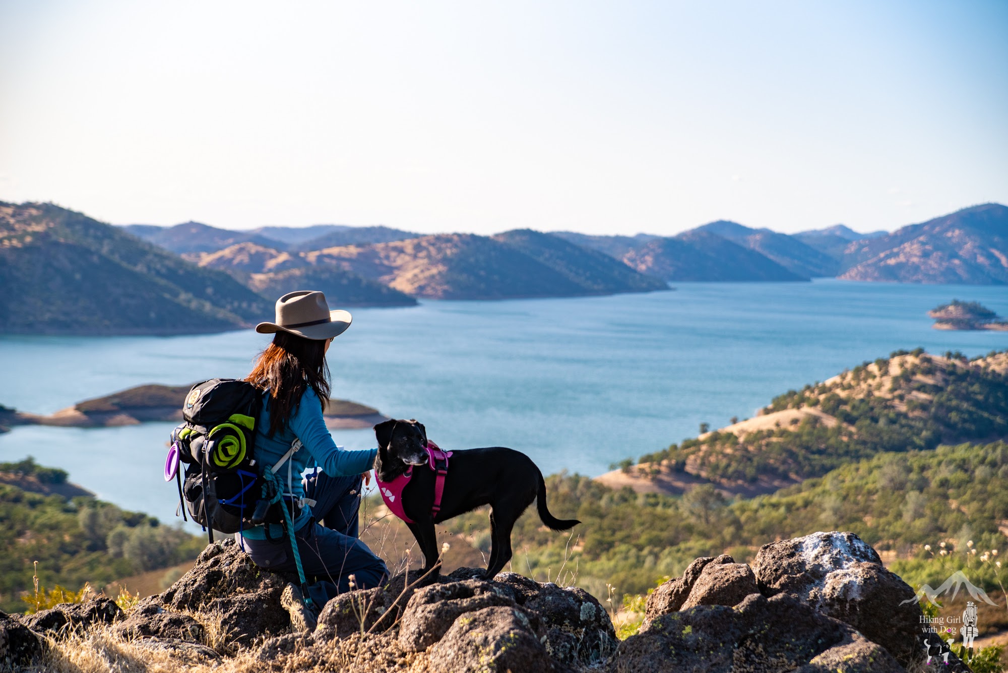
And the view of the New Melones Lake is breathtaking from the top!
KEEN Footwear discounts starting at 25% OFF
When you are ready, go back the way you came up. It’s an out and back trail.
Good to Know:
- Hike Date: 9.30.2019
- Distance: 2.4 miles RT
- Elevation Gain: 607 ft
- Maximum Altitude: 1,919 ft
- Mountain Range: Sierra Nevada
- Difficulty Rating: Moderate
- Trailhead: 37.943979, -120.462067 (copy/paste to your GPS)
- Fee/Permit: None
- Vault toilet available at halfway
- Notable: exposed, rock climbing
Get Our Latest Comprehensive Dog-friendly Trail List Here. Enjoy!
Happy Hiking!

KEEN Footwear discounts starting at 25% OFF


