I have to backtrack and share our hikes in the springtime. I normally share our adventure stories in chronological order but I was too excited to tell you about the glamping trip that I skipped over some of our springtime hikes.
This is a hike we did back in March while chasing wildflowers.
I entered Box Springs Mountain Reserve Park into my GPS and drove to Riverside County. I arrived at the park via Hidden Springs Drive and parked in the overflow lot outside of the park for free.
The trail was clearly visible from the parking lot. We passed the main parking lot and walked to the trailhead. Southern California had a good rainy season past winter so the earth was happy. I’ve never seen Riverside County this green. Ever.

This is a popular hike among the locals so there are many use trails that were made to create shortcuts. A lot of times, it might be hard to tell between a use trail and the actual trail.
Here is a tip. If the incline is too steep, you are most likely on a use trail. At one point, we were climbing the rocks straight up. Everyone was on this part of the mountain scrambling so I didn’t even notice the modest-looking trail to the left at the bottom of this rocky hill. It wasn’t until later when we were walking back I realized this. Oops.
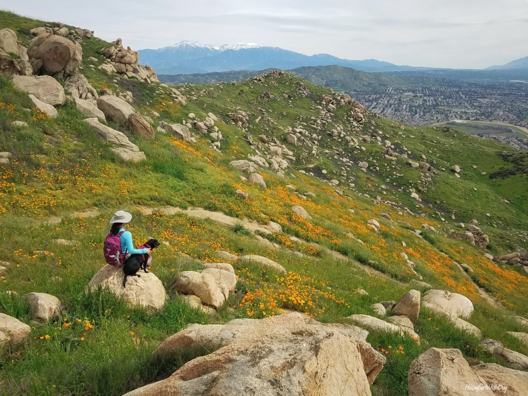
At the top, we met up with the trail again. At this point, I started looking for the blooming California poppies. Then, voila!

The snow-capped Mt San Jacinto in the distance was a great contrast to the bright sunburst orange poppies.

Xena liked the poppies as much as I did or she just picked up my happy mood and was happy for me. Pups are in-tune with you like that. Best Friend Forever.

The last part of the incline to the “M” is short but steep.

This short but challenging hike is good for winter, spring, and fall. There is no shade on this trail. Make sure to wear shoes with good traction to avoid injury. I saw many people hiking this trail unprepared. As always, wear proper shoes and take enough water and snacks for both you and your pup when you are exploring.
Good to Know:
- Hike Date: 3.4.17
- Trail name: “M” Trail
- Trailhead: 33.965659, -117.266061 (copy and paste it to your GPS app)
- Distance: 3.3 miles RT
- Elevation Gain: 1,107 feet
- Difficulty Level: Challenging
- Parking: $5/vehicle if you park inside the park


Beautiful!
Thank you 😊
Gorgeous!!
Thank you! :)
Xena looks gorgeous among the poppies. I mean she does anyway, the colours just seem to pop. Wow.
Aww thank you! Black goes with everything! ;-)