This popular hike is a 10-mile roundtrip if you don’t get lost. But we got lost. From the beginning. There are two forest service gates. Go through the one at the end of the parking lot. Because a big group was congregating near the first gate, I assumed that was the right gate. Else why would they be meeting there, right? Later I found out that that was the meeting place for the people who signed up for bungee jumping at the bridge. sigh.
Pretty soon I realized that we were scrambling for no good reason, I turned us around and walked back to the parking area. Then, I saw the other gate we were supposed to go through. I felt pretty silly at that moment.
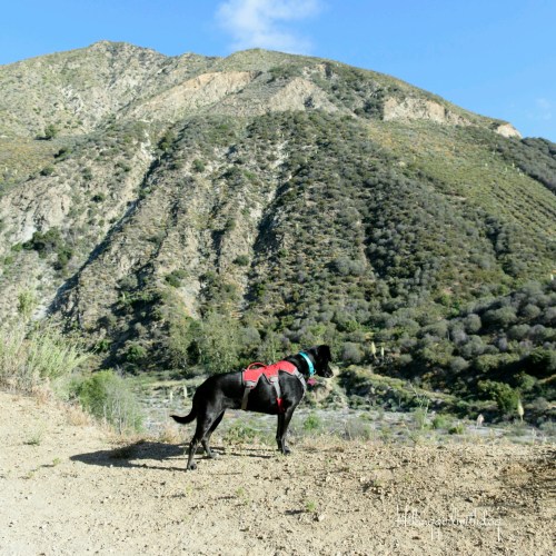
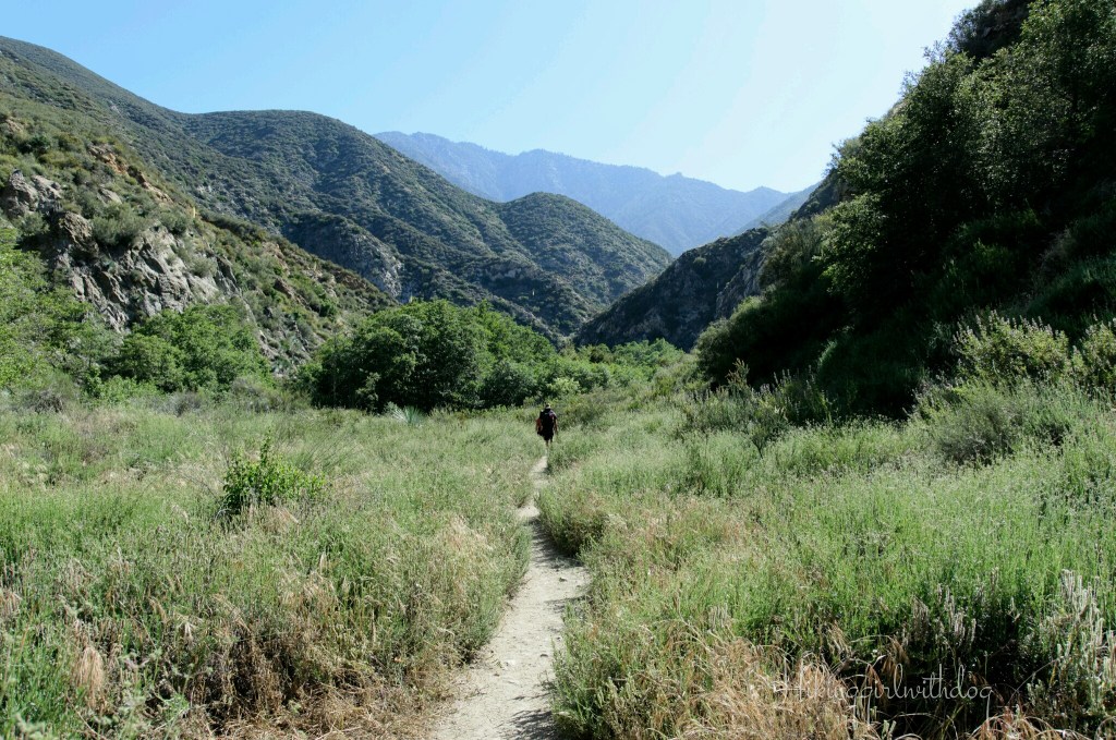
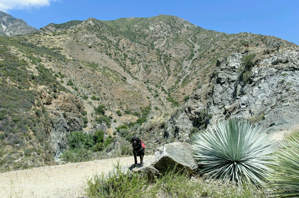
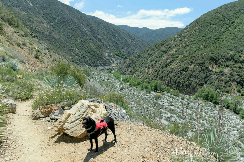
The real hike started out easy. The fire road was on a slight downward slope and the view of San Gabriel Canyon was inviting. It was an unusually cool morning in May. It was 48 degrees. I was glad we didn’t waste too much of a pleasantly cool morning by getting lost.

Soon we were able to see and hear the stream from the trail. We passed the Heaton Flat trailhead and a campsite next to the stream. From here, Bridge to Nowhere is 4.2 miles away. There is a porta-potty here but the frequency of the maintenance is questionable judging by the smell from outside.
At about 1 mile, we came to the stream. It doesn’t look deep or wide in the picture but it was deeper and wider than I expected. I took off my socks and shoes and changed into my brand-new water shoes. Oh my! To my surprise, the water was ice cold! The deeper part of the stream came to my mid calves. This picture was taken after we crossed.
The first stream crossing was a bit chaotic. I was in cold water shock and trying to find a shallow section for Xena to cross. She didn’t know why I was walking gingerly and looked painful in the water. She was concerned and hesitant to cross the stream.
My toes were freezing. I dried my feet and put the socks and shoes back on. Ahh, warmth again. I quickly realized that it was a mistake to pack those water shoes. There was no way I was going to keep that cold wet water shoes on.
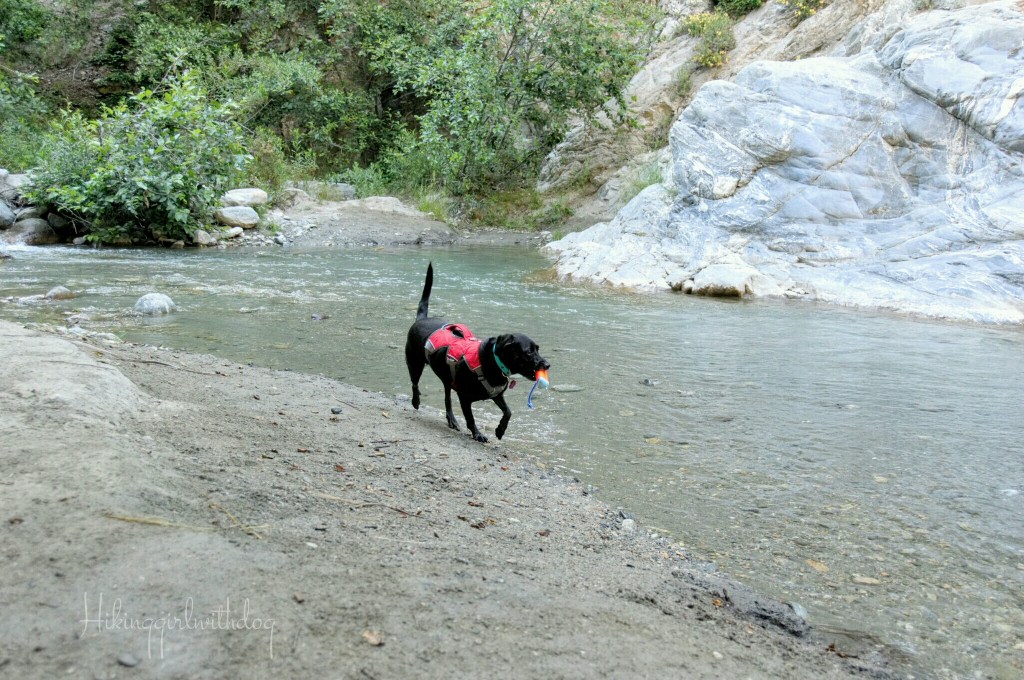
Also, the trail was rocky and the shoes had no support or protection against the rocks. Gear failure. “Wow, I have to do this 6 more times?” I thought. Little I knew I was about to get lost and cross the stream a lot more than needed to. While I was putting my shoes back on, I threw a toy for Xena so she can at least play and move around.
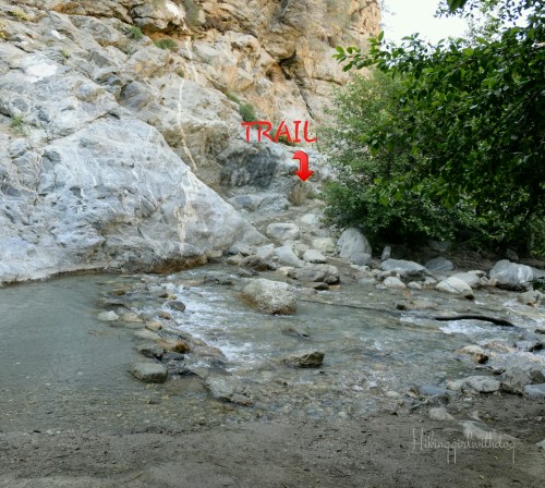
Right after this, go straight until you find a dirt trail. I took a rocky path instead that turned to the right. I saw wet boot prints so I followed them. I followed hikers who were lost and I didn’t realize it at that time. We stayed off trail which required lots of unnecessary boulder climbing and more stream crossing. Shoes off. Shoes on. I was getting tired of it and it slowed us down but I didn’t want to hike the rest of the trail in wet socks/shoes. Ugh.

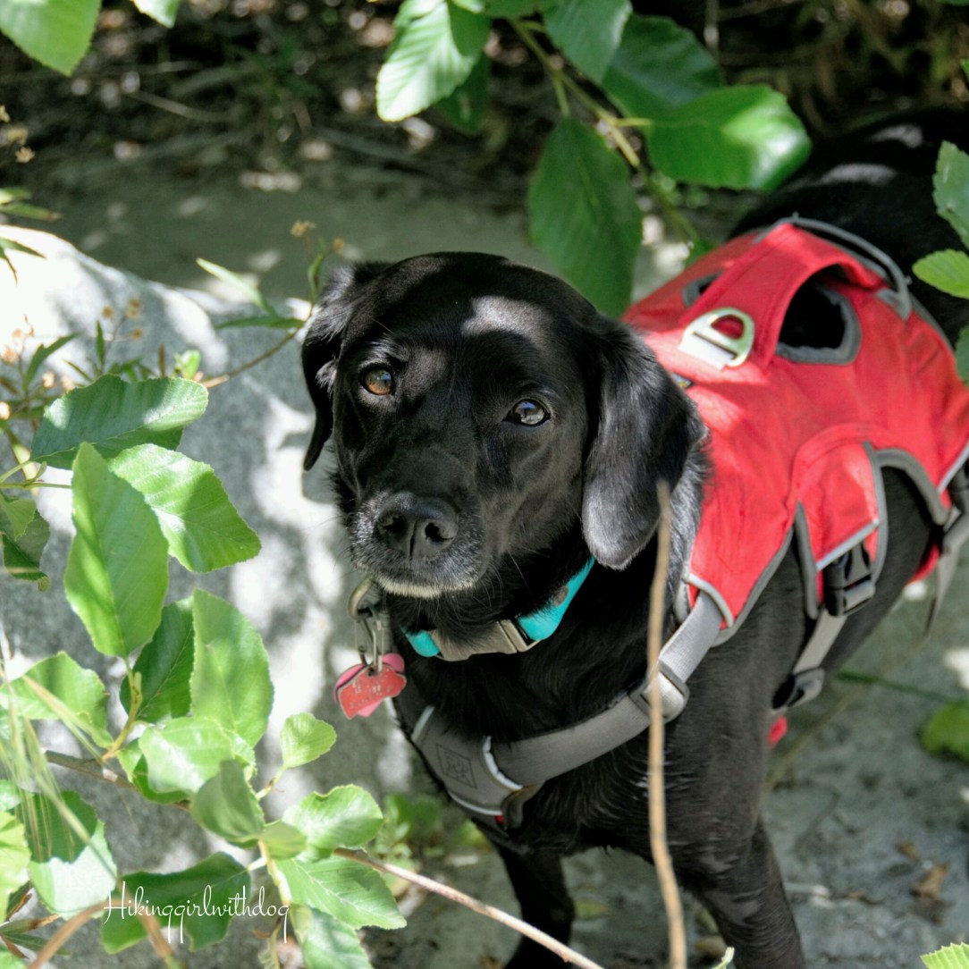
Xena never panicked in the water. She stayed with me against her fear of water. I was so proud of her. Sometimes, the water came up to her chin and had a swift current. Only in those situations, I helped her to cross. The handle on her Webmaster harness came in handy as usual.
I was especially worried about her paws getting injured by dry broken branches and sharp rocks because that was pretty much the condition of our trek. Most of the time, we were alone. I stayed with the stream hoping that it will eventually take us to the trail. Occasionally we came across other lost hikers. But they moved faster than us and they were out of our sight as quickly as they appeared.
Finally, I found a trail about 2.5 miles into the hike. No more bushwhacking but there were no more coverings to keep us cool either. From here on, it was all exposed.
Soon, we came to a little bridge and there was a sign that we are now entering into Sheep Mountain Wilderness. That was the only sign I saw after the Heaten Flat trailhead. We crossed the stream a couple more times which kept us cool. I didn’t even have to pull out her Swamp Cooler vest.

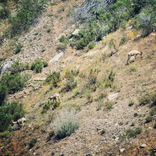
As we got closer to the bridge, there were more hikers around us. I really have no idea where they all came from all of a sudden. At some point, someone spotted a herd of bighorn sheep up on the hill across from us. Pretty cool!
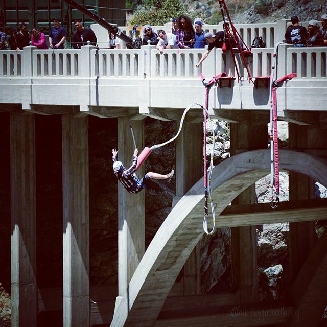
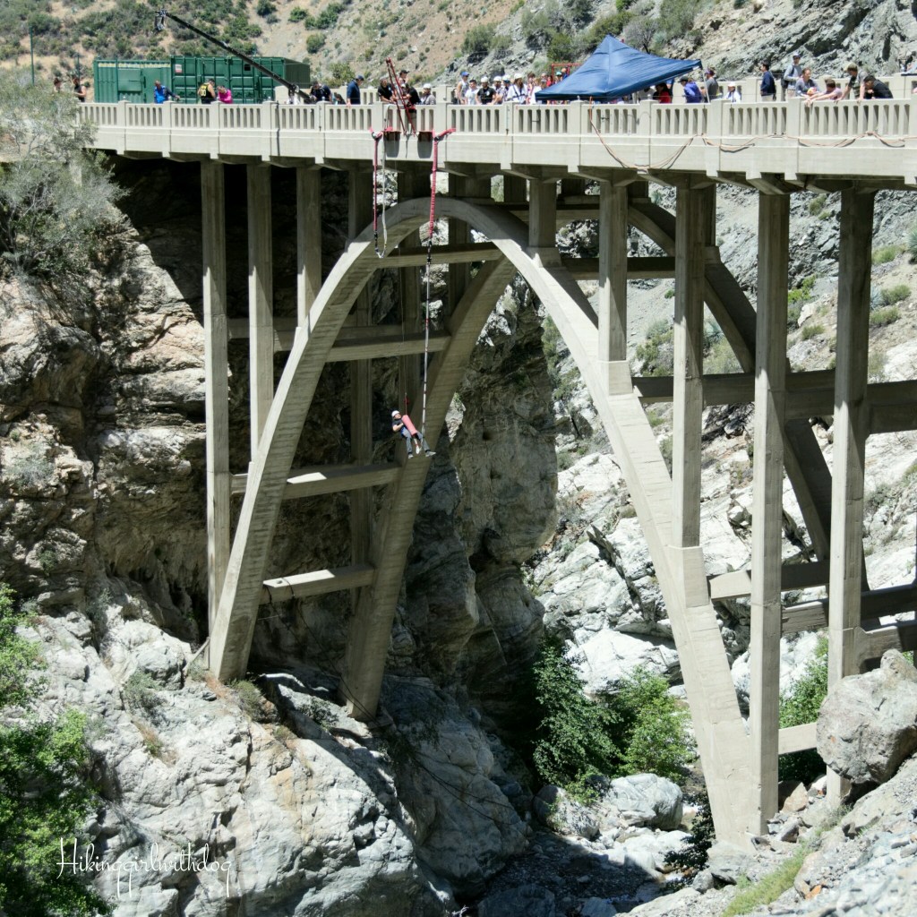
About 0.25 miles after that, we arrived at Bridge to Nowhere. We walked past the crowd who were in line for the bungee jumping then took this photo.

Luckily I was able to find us a shady spot to rest. It was a small nook next to a rock wall just enough for two of us. We ate our lunch and watched people.


After food and rest for about 25 minutes or so in the shade, we both felt rejuvenated. When I started to pack up our gear, a few people were scrambling to take our spot. A shady area was hard to come by. With a recharged body and mind, we enjoyed our surroundings and fantastic views.
I was determined to not get us lost again this time for Xena’s sake. When the trail started to get hazy again, I followed a big group. I was fighting against the increasing temperature and the heat from the ground was getting stronger too. Since she is closer to the ground, I need to consider that as well. The temperature was in the mid-’60s and not having the shade definitely created a challenge. I wasn’t going to extend already her longest hike potentially longer in the heat.

Find a perfect harness for your adventure dog at Ruffwear!
It took us 6 hours and 30 minutes including the stops. What an adventure! We both were pretty tired by the time we got back to the car. It was more from scrambling in the first half and the heat during the second half of the hike. On the way back, I didn’t bother taking socks and shoes off. I only had to walk in wet shoes a few miles anyway. By then the water felt really nice and refreshing. Xena got comfortable walking through the stream too. She didn’t hesitate anymore. That was a big accomplishment!

I will go back. Next time, I will remember to take my trekking poles. They would have come in handy when crossing the stream.
Good to Know:
- Hike Date: 5.22.16
- Distance: 10 miles RT
- Elevation gain: 1,422 ft. (starting @ 2,236 feet)
- Porta-potty at the trailhead and Heaton Flat Trailhead
- Fee/Permit: California Forest Adventure Pass required ($5/day or $30/annual).
- If interested in bungee jumping, click here to purchase a ticket from Cloud 9 Living.
- Notable: stream crossing, arch bridge, bungee jumping (optional), and possible wildlife sighting
- Trailhead Coordinates: 34.236981, -117.765305 (copy and paste it to your GPS)


I have been in the “lost” position several times. Loved your sense of humor in this post. Sometimes you just have to have that when a hike doesn’t go as you think it will.
Haha, thank you. What can I say. I am directionally-challenged at times. :) No obstacles, no adventure, right? ;-) Have a great weekend!
Hope you had a great weekend as well!
Yes! I can relate to getting lost with my dog. I’ve had a hard time finding the trailhead. My dog was refusing to follow me after a while.. finally I dragged him on leash downhill to the trail. He was happy after that but it’s says confusing for me to find the trail ..
Haha! Hope you two had a great time! It’s a great summer hike because of the stream crossing.