Hello everyone! Sorry for the late post. This is a hike I did at the end of November. I usually post a hike within a month but with holidays and all, I just got around to write about it.
The trailhead starts the western side of the parking lot in Bailey Canyon Park (address provided below). Follow the footpath and pass through a turnstile then turn right. You will be on the pavement but do not worry, this part is short. Keep going until you see the Flash Flood Area sign. Trail changes to dirt behind the sign and things get better.

When you reach the first Bailey Canyon sign, go straight towards the waterfall.

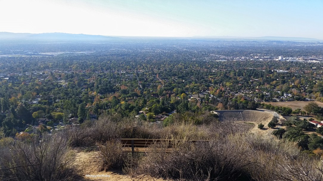
When we came across the second sign, we went towards Bailey Canyon Trail. From here on, it was all uphill, and we had fantastic views of San Gabriel and L.A. basin along the way. Soon, we reached the Indian Lookout Point. There are a couple benches at this lookout. This could be a good turning point if you are a beginner.
Continue on Bailey Canyon Trail. I love everything about the next picture. Two of my favorite girls in nature and the moon above on a clear blue sky. Let me translate the scene for you. H: ‘”Are you coming?” X: “Don’t you think we should wait for mama?”

The single track continued all the way to the peak. This area was so green! Just lovely! Some parts of the trail were shady like here, but most of the path is exposed, and it reminded me of Sam Merrill Trail in Altadena very much except it wasn’t crowded.

After hiking uphill for 3.2 miles, we arrived at Jones Peak (elev. 3,386 feet). There is no sign for the actual peak on the trail. You will need to look for a footpath that goes up the hill on your right from Bailey Canyon Trail.
There is a bench to sit and enjoy the view. We had the whole place to ourselves for 10 minutes or so until a group of about 10 hikers – maybe a meetup group – came up and took over the place. I got distracted and forgot to take photos there. Sorry.
When you are ready, go back the way you came up. It’s an out and back trail. It was around 10:15 AM when we headed back to the trailhead. We wanted to get back to the car before it got too warm for Xena.


Good to Know:
- Hike Date: 11.29.2015
- Distance: 6.4 miles
- Elevation Gain: 2,240 ft
- Trailhead: 451 W Carter Ave, Sierra Madre, CA 91024
- Difficulty Rating: Difficult
- Restroom at the trailhead
- Permit/Fee: None
I just got back from my annual after holidays desert trip. I can’t wait to share that trip with you! I had a wonderful time at Joshua Tree National Park. But before then, I have another hike to share. This one is from December. Stay tuned. :)
Get Our Latest Comprehensive Dog-friendly Trail List Here. Enjoy!
Happy Hiking!

KEEN Footwear discounts starting at 25% OFF


Looks amazing!
It was a challenging one! I had this hike on my list since last spring but I waited so I can do it this winter. Views are much clear and better in the winter time in SoCal.
Beautiful hike!
Yes, it was a nice one. :)