
For my first hike in Ventura County, I chose Rocky Peak and I was not disappointed.
Winter Hike #8: Chatsworth, CA
As you already know from my last post, this hike was (and always will be) a memorable one. Now, I get to share with you the beauty of the trail.
The distance to the peak is 2.5 miles from the trailhead, which makes this a 5-mile out-and-back trail with an elevation gain of 1,056 feet. Rocky Peak fire road has a steady incline until it reaches the peak at 2,636 feet.
Unfortunately, the peak isn’t nicely marked so you can easily pass by it without realizing it. I had a few people asking me where the peak was after they passed it. When the incline finally flattens out and there are big rocks on your right, you are at the peak. You will have the view below.
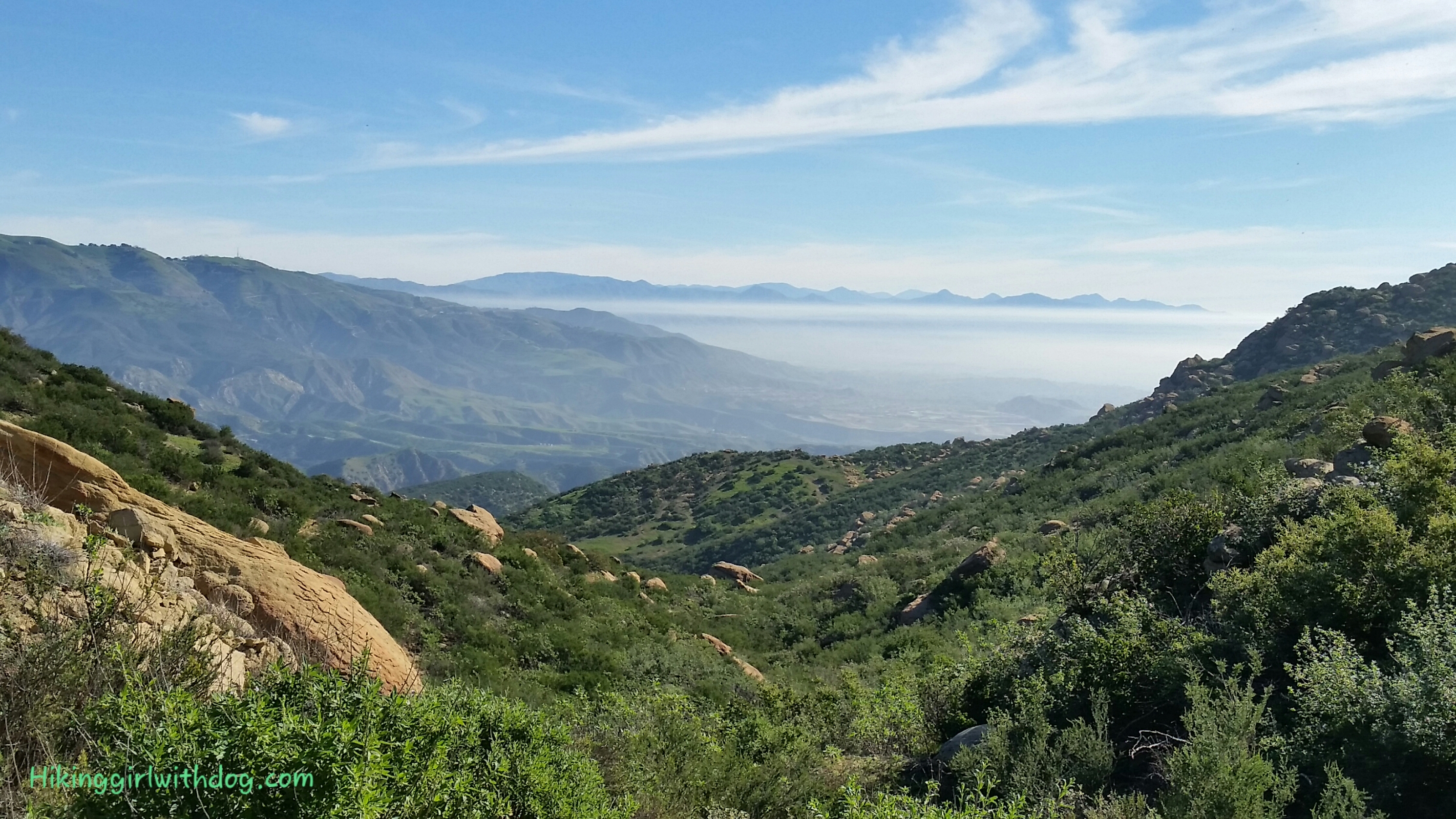
View of Simi Valley and Moorpark from Rocky Peak

View of Simi Valley and my happy feet well protected in the new hiking shoes

The fire road continues when you reach the peak so you can continue on if you like. In fact, that’s what I did with Xena. The rocky terrain was fascinating since it was new to me.
The views throughout the hike were beautiful and addicting. Rocky Peak Fire Road can be reached from other trails nearby such as Hummingbird Trail starting from Canyon Oaks Dr. and Chumash Trail starting from Evening Sky Dr. or Flanagan Dr.
One hiker told me that if you come from Yosemite Ave (He must be talking about Chumash Trail), you can see deer at times. Oh! That sounds so much nicer than having a face-to-face with an agitated rattlesnake!


Good to Know:
Take the Rocky Peak exit from Freeway 118 (Ronald Reagan Fwy). It takes you right up to the trailhead where there is a tiny parking lot. Instead, if you turn left at the end of the ramp and drive above the freeway, there is free street parking on Santa Susana Pass Rd. That’s where I parked. There were plenty of parking spaces at 7:30 AM.
Take lots of water for you and your pup as there is not much shade on this trail.
Good to Know:
- Hike Date: 2.16.15
- Distance: 8 miles RT
- Elevation Gain: 1,318 ft.
- Trailhead Coordinates: 34.268389, -118.636139 (copy and paste it into your GPS)
- Difficulty Rating: Challenging
- Permit/Fee: None
- Notable: No shade
Get Our Latest Comprehensive Dog-friendly Trail List Here. Enjoy!
Happy Hiking!


Very beautiful pictures!
Thank you! It was a gorgeous day.
Great pictures. It looks like a very nice hiking trail :D
Thank you! Yes, it was. Memorable in many ways. 😉
Beautiful views in this hike! :)
Glad you enjoyed it. 😊 Thanks for reading!