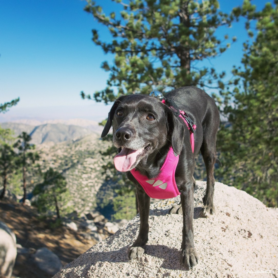
After parking at the little dirt lot at Cloudburst Summit, we began our hike on the small trail off Angeles Crest Hwy (Hwy 2). If you are facing the fire road, this trail is on your left. You can do the Winston Peak loop via the fire road as well. After 0.6 miles and 375 feet of elevation gain, we reached Winston Peak (7,502′). That was quick! Now what?
I didn’t drive 90 minutes to do a mini hike! My plan was to hit Winston Peak then hike over to Winston Ridge then return making a loop like this:
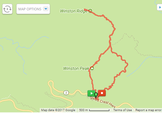
Although this route is only 5-mile long, this wasn’t an easy hike. The descent from Winston Peak was steep.

The Clymb: Save Up to 70% on Industry Leading Outdoor Brands! Shop Now
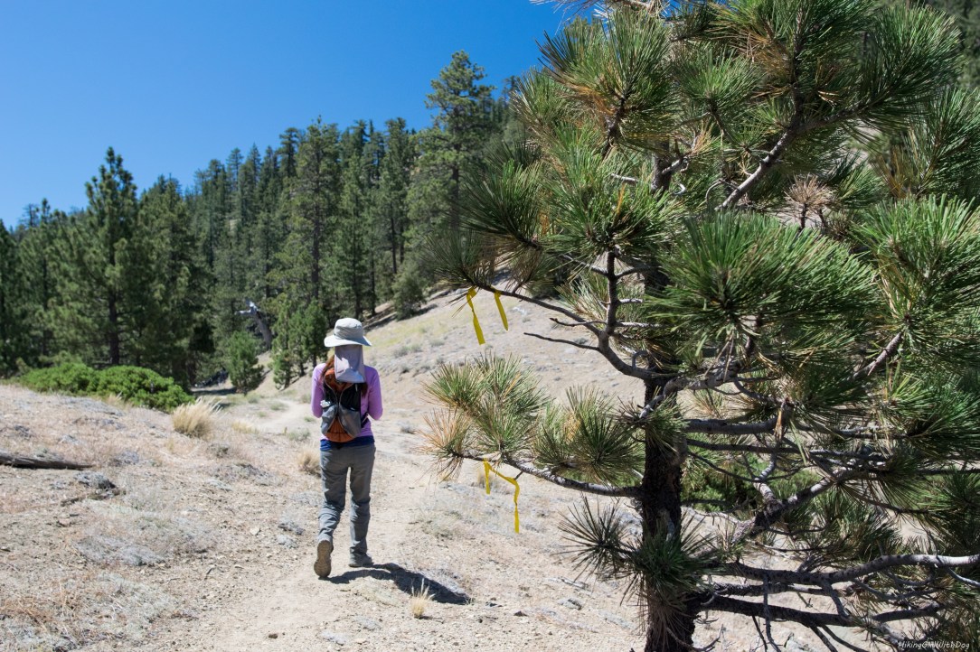
Eventually, we made it down and the trail leveled out. At the 1.2 mile marker, we came to a junction where the trail met up with Pacific Crest Trail (PCT). From here, we took a trail on the left toward the northwest. Next 0.5 miles or so of the trail is lightly trafficked and not well maintained. The trail is super narrow and it’s on a steep slope. Sometimes it wasn’t easy to spot the trail.

After about 0.5 miles, the trail changed the direction to the west and we were no longer hiking on a steep slope. At the 2.1 mile marker, we reached Winston Ridge. It was a nice surprise to find some shades there and the cool breeze was refreshing at the top.

I told her to eat her snacks slowly so we can all eat at the same time but somebody didn’t listen.

Did I mention this hike wasn’t easy? We had to climb over a couple of huge trees that were fallen over the trail both ways. It would’ve been more challenging had my sister was not there with me. There wasn’t enough space under the tree for Xena to go through, she tried though trying a couple of different spots, and the tree was too tall for her to jump on especially on a slope. So my sister and I had to help her to go over the tree using a little teamwork.

The Clymb: Save Up to 70% on Industry Leading Outdoor Brands! Shop Now
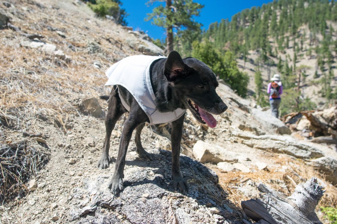
Oh, then it started to get hot although it was still morning. It was July after all. Cooling vest on.
When we reached PCT, we took PCT to go back to the car. The trail was mostly flat first then had a gradual ascent through Pleasant View Ridge Wilderness. This route was pleasant indeed. The trail was well maintained and partially shaded.
To make sure Xena doesn’t get overheated, we made lots of stops for water and rest along the way.

Good to Know:
- Hike Date: 7.22.17
- Distance: 5 miles RT
- Elevation Gain: 1,169 ft
- Trailhead: Google Cloudburst Summit
- Difficulty Rating: Challenging
- California Adventure Pass is required for parking
- No toilet
Get Our Latest Comprehensive Dog-friendly Trail List Here. Enjoy!
Happy Hiking!

The Clymb: Save Up to 70% on Industry Leading Outdoor Brands! Shop Now


Amazing pictures & (paw)esome hiking buddy 🐕
Thank you so much! Yes, she is a great hiking buddy! :)
That was a fun hike in the Angeles high country that doesn’t get much attention. Great pics!
Thank you, David! Yes it was a fun hike with obstacles! We only ran in to a pair of hikers on PCT. Other than that, we were alone the whole time. I enjoyed that very much.
HA! Joey never waits for me when it comes to snacks either! LOL!!! Looks like a great hike!
Who am I kidding?!! Psssh, eat slowly… LOL!