In the Tonto National Forest near Apache Junction, Peralta Trailhead is located 49 miles east of Phoenix, Arizona in the Superstition Mountains.
Peralta Road to the trailhead is a dirt road but you don’t need a high clearance car. There is plenty of parking in the lot but it gets full by mid-morning during on weekends. We arrived at 8:30 AM and had no issue finding parking.
There were two friendly rangers at the trailhead who were helpful to hikers who had questions. Also, there were maps and other information on the Superstition Wilderness.

Peralta Trail is well-maintained so it’s easy to follow. I read that the trail is lightly trafficked but I would say it’s moderately to highly trafficked on weekends depending on the time of the day. Once we got separated from people, I let Xena off-leash.
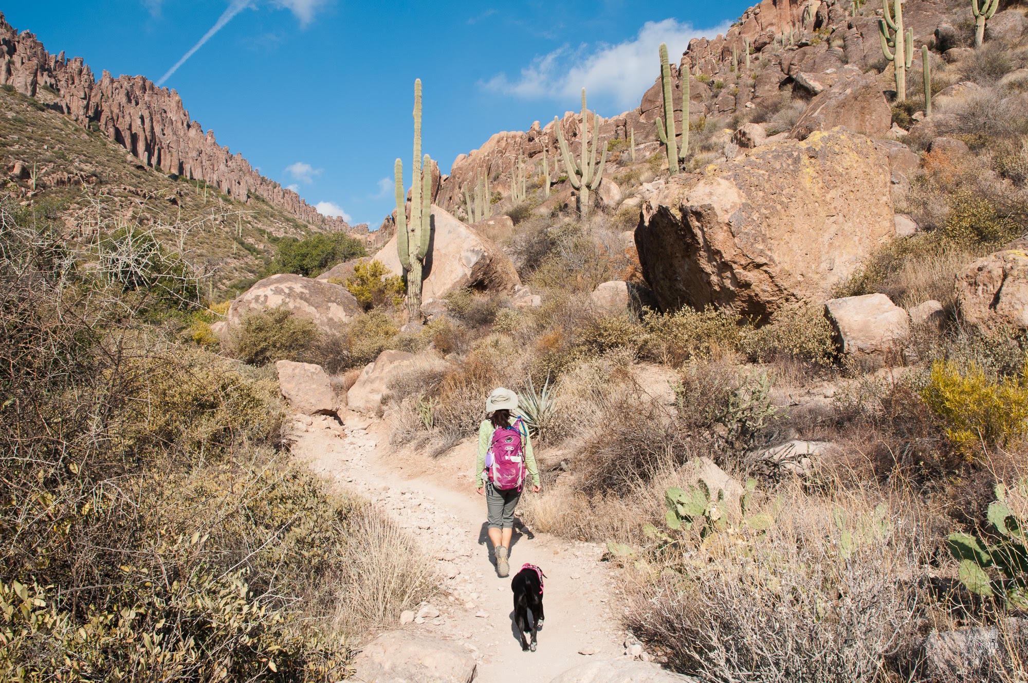
It’s inclined most of the way up to Fremont Saddle. Loose gravel made it slippery at times and the terrain stayed rocky for the most part. I recommend proper hiking shoes for this hike. If your shoes have soft outer soles, you will end up with sore feet at the end of the hike.

I just loved the rugged and majestic landscape of the Superstition Mountains.
So different from our local mountains. Love saguaros!! I couldn’t stop taking photos.
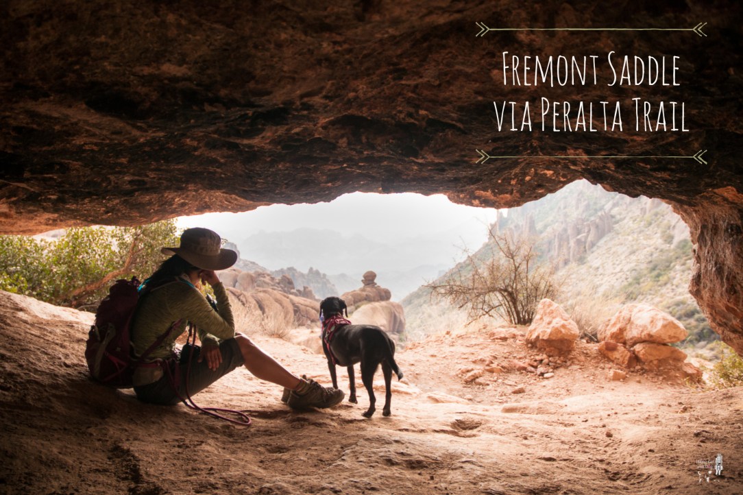
At the 2-mile marker, we came to a cave. We sat there for a little bit and watched other hikers walk by. A good place for a water break. I was glad about the overcast sky because the trail was exposed after the first mile.

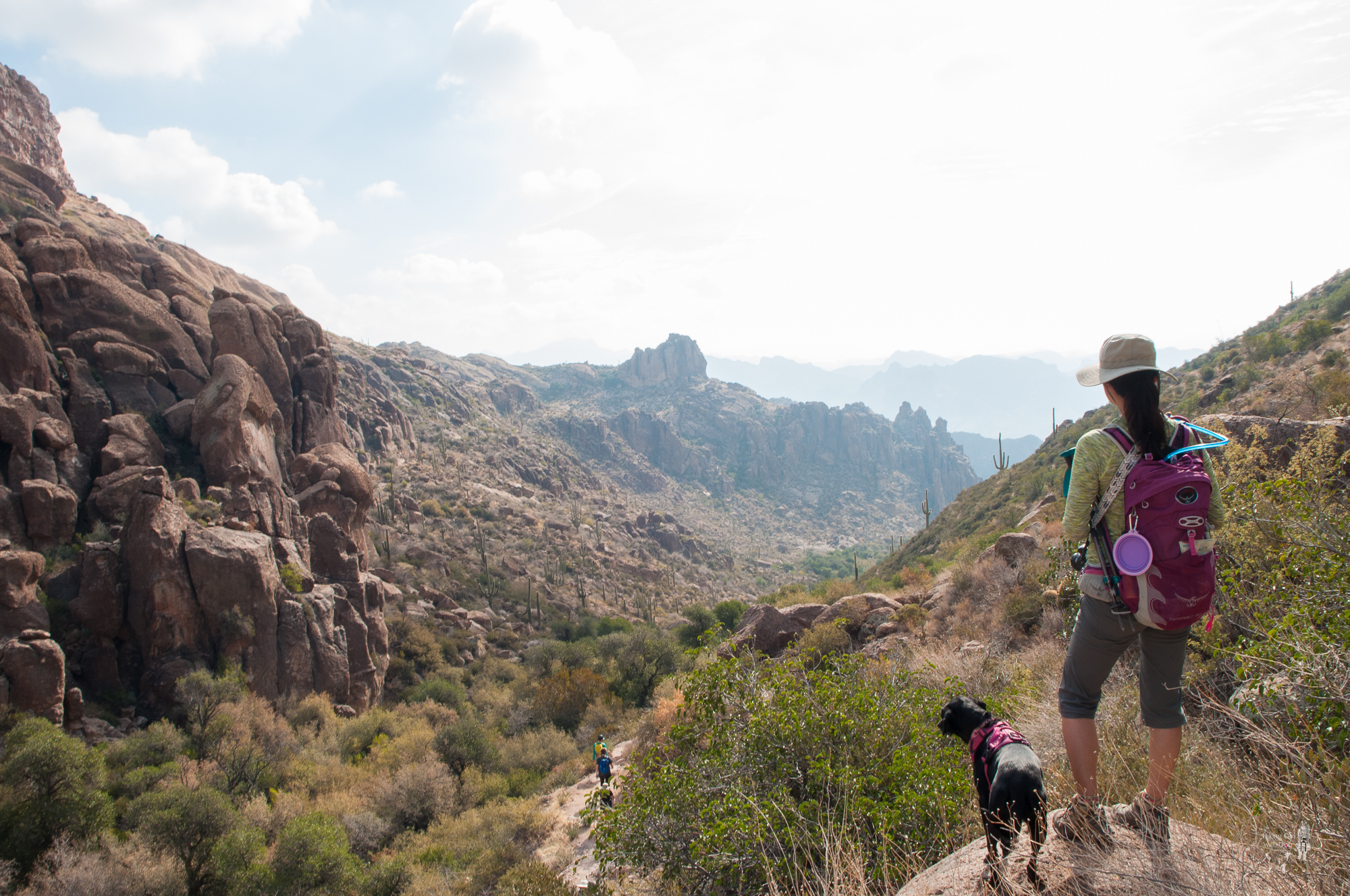
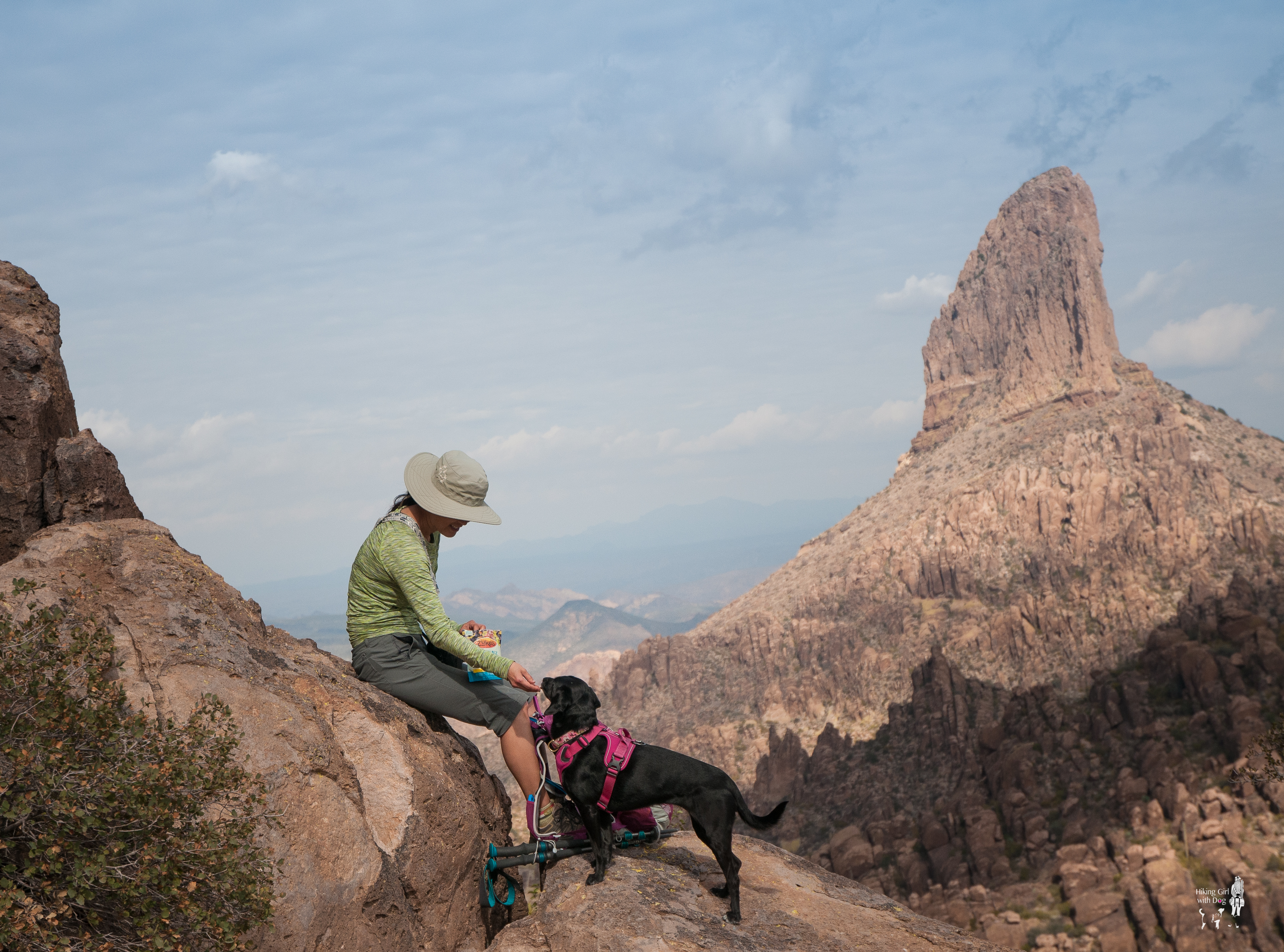
After 2.25 miles, we reached Fremont Saddle where we had the view of Weaver Needle.

The trail continues on but this is a good place to turn around if you just want a day hike so that’s what we did after the snack break.
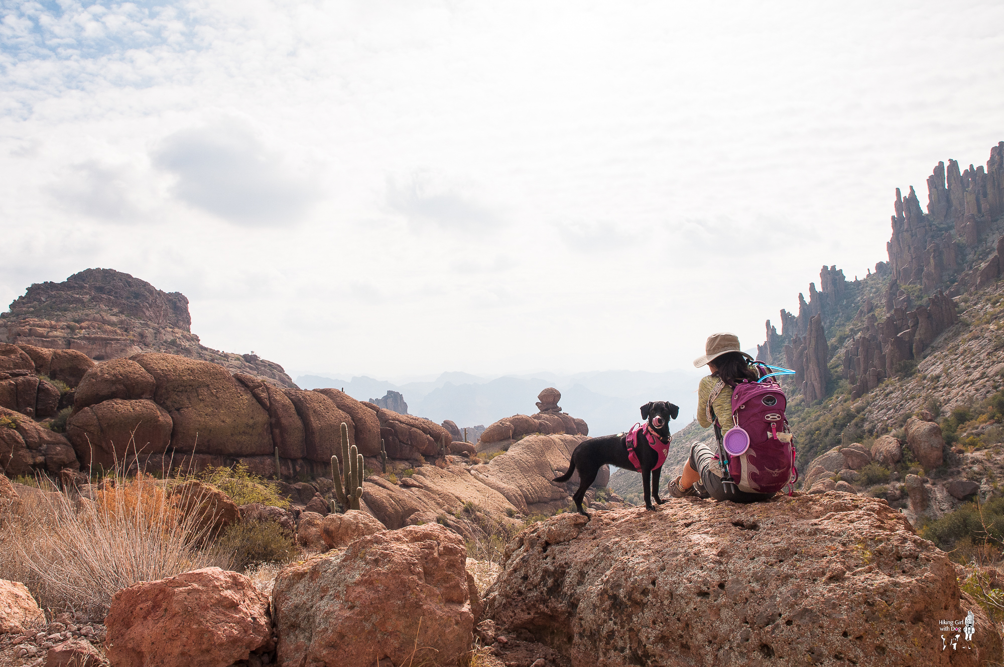
The rocky terrain makes Xena’s paws tender. She likes having her boots on for this type of terrain so boots on for the downhill.
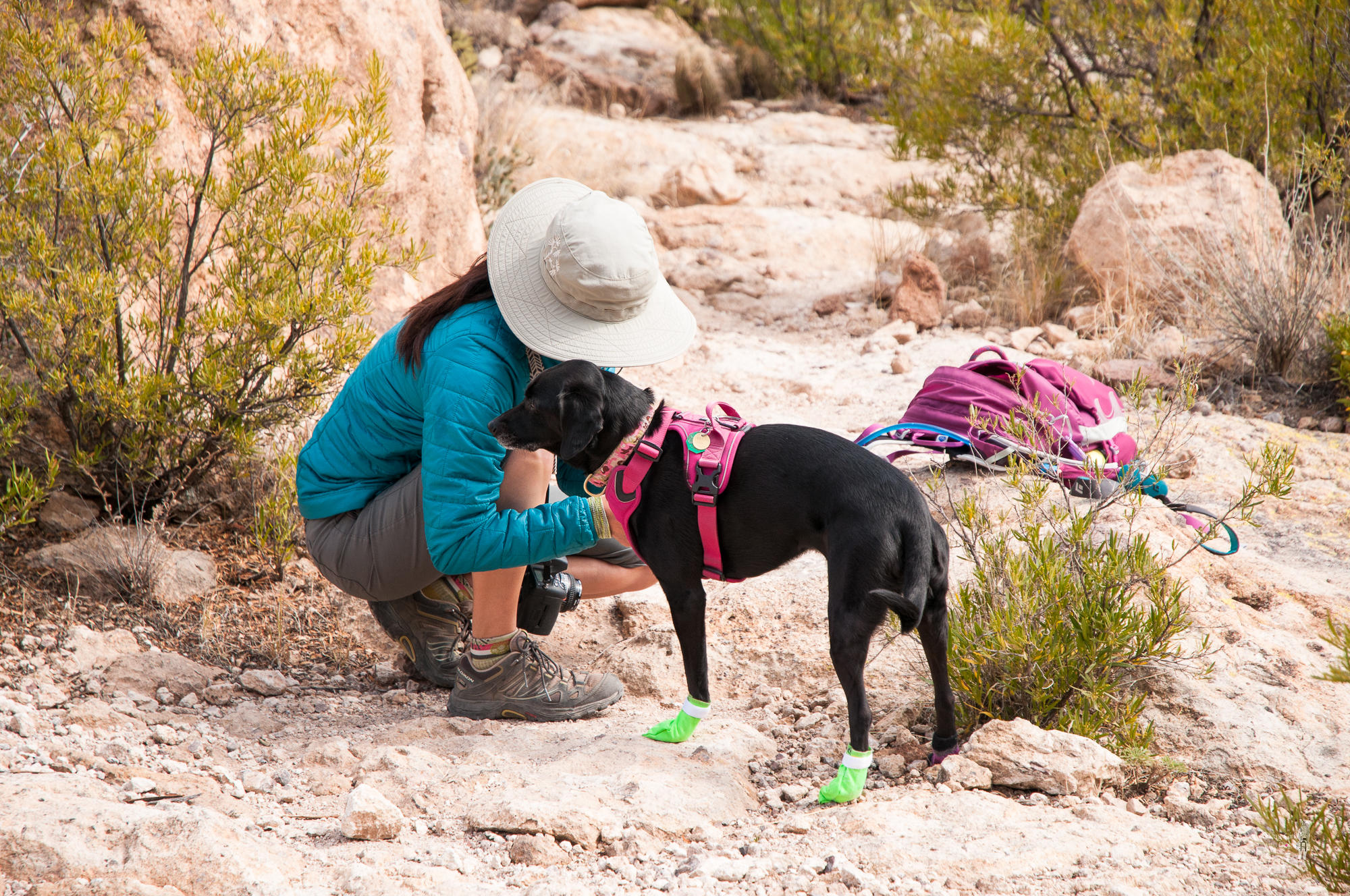
I know she’s happier with the boots on because she passes me and smiles back.

The view is always better on the way down. Enjoy!


Good to Know:
- Hike Date: 2.18.18
- Distance: 4.5 miles
- Elevation Gain: 1,367 feet (max 3,672 ft)
- Difficulty Rating: Challenging
- Trailhead Coordinates: 33.397565, -111.347866 (copy and paste it into your GPS)
- Notables: No shade, high-trafficked, some scrambling required
- Permit/Fee: None


I was just watching a documentary on the Superstition Mountain lol! Great pics!
Great timing! :) Thank you, will you be going there soon?
No plans to but would love to lol
All of these walks look great, it’s just a shame they’re a good few thousand miles away!
Add to the travel wish list?
It’s getting rather long :P
Haha, mine too. But that’s awesome though. Time to start making plans. 👍
Oh I have plans believe me, I just need money XD
😂
Love Xena’s hiking boots! Looks like a wonderful hike.
They make her paws feel better! Not to mention all the attention she gets from other hikers. :) It was a beautiful hike!
Welcome to my neck of the woods! Hope you enjoyed the trip.
Thanks, Max. We sure did! I’d like to go back and explore the Superstitions more! It was beautiful!
It’s my favorite wilderness! Let me know if you ever have any questions about routes or camping sites– if I don’t know the answer I’m sure I know someone who does!
I can see why. It’s breathtaking! I sure will!! Thanks Max. Have a great day!
GREAT VIEWS!!
It was beautiful!
This looks like a gorgeous hike!
It really was! I am definitely going back to the Superstition Wilderness next winter to explore more!
Amazing views and informative post! Want to visit and hike there someday with my dog. He would love it there!
Thank you so much! It was beautiful and fun. I am looking forward to going back and explore the area more next winter.