In the winter of 2020, I shared the hike to the top of this waterfall. I am ready to share the hike to the bottom of the waterfall in the springtime.
Please follow the previous write-up if you are doing this hike as the hiking route is the same until the very last portion near the waterfall. There isn’t a significant difference in the total distance and the elevation gain between the two hikes.
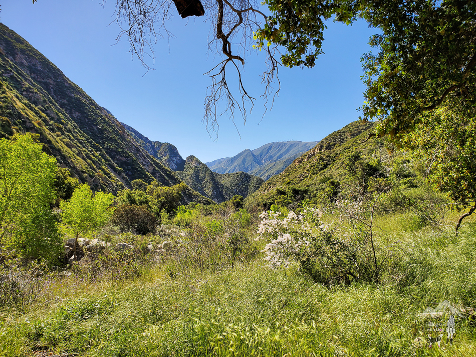
This hike is in the Angeles National Forest near Sun Valley.
We had some heavy rains until March this year, which made this year’s hike feel and look so different than in the past. I think it warrants a separate post, even if it’s just to share the photos from our most recent trip. It has such a different vibe than the last post.
Of all the times I’ve hiked here, I never saw this stream near the cabins flowing until last year.

Please note, after passing the cabins, there are no signs for the trail or the waterfall. It would be helpful to follow GPS.
After a good rainy season, expect to cross multiple streams. There was plenty of water even at the end of April.
Young Bailey was timid about stream crossing at first, but with lots of encouragement, she eventually became more comfortable. Having to cross multiple times and having Xena there to show Bailey how to do it helped, for sure. Dogs learn faster from other dogs.

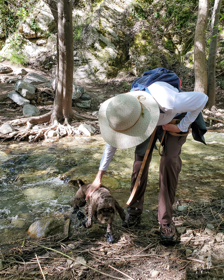
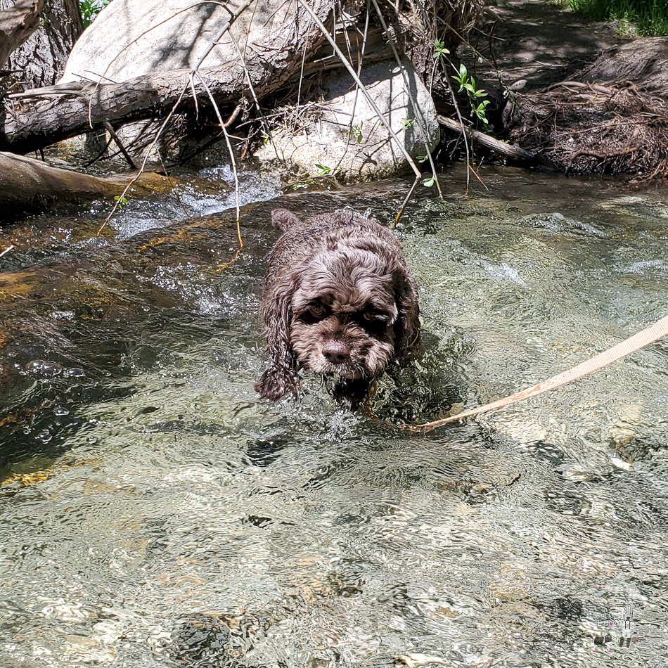
It wasn’t always easy to find stones to step on, so we just walked through the streams. It was so much more fun, easier, and refreshing too.

Shop gear for your backcountry dog now at Ruffwear.com


After the trail starts to ascend, there is no shade. This section of the trail is narrow, and it can feel hot even during the winter months if there are no clouds. Bring plenty of water.
Eventually, the trail leveled out, and soon we could see and hear the waterfall in the distance. It was partially shaded in this section of the trail early in the morning. Did I mention that we started at 8 AM?
If you are tracking GPS, at about 2 miles, start looking for a side trail on the right. It’s unmarked and looks more like a used path than a trail.
There are two side trails close to each other. The first one leads you down to the waterfall, and the second one leads you down to the top of the waterfall.
Since these are unmarked detours, they are easy to miss. You will need to look for them.
Here, we encountered a coiled snake on the side of the trail inside a bush. It wasn’t a rattlesnake. Nevertheless, I was relieved that I was the only one who saw it. The snake had no interest in us, and the dogs seemed to be unaware of the situation. On the journey back, the snake was no longer there.
We took the first trail. Quickly, the slope got steep, and a bit slippery due to loose dirt, even with hiking shoes. A bit of scrambling is required here. There are ropes to guide you while climbing down.


This hike can get crowded during the rainy season, especially on weekends. The streams will be fuller and higher than in my photos, too. Trekking poles will come in handy for balancing when crossing the streams.
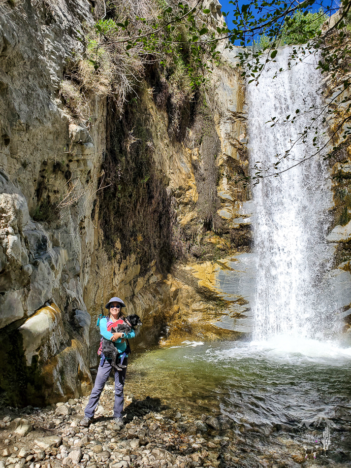
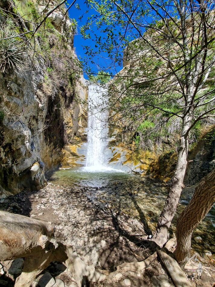
As for me, I avoid going on weekends. I prefer enjoying nature without the crowd. On that day, we enjoyed this 30 to 40-foot Trail Canyon Falls all to ourselves.
Good to Know:
- Hike Date: 4.21.23
- Distance: 4.8 miles RT
- Elevation Gain: 860 ft.
- Difficulty Level: Moderate
- Fee/Permit: None
- Trailhead/Parking: 34.303715, -118.258211
- Notable: National Forest, partly shaded, seasonal waterfall, snakes, wildflowers, scrambling, no bathroom
Get Our Latest Comprehensive Dog-friendly Trail List Here. Enjoy!
Happy Hiking!


